Atoka Sands (Pregnant Shale or Davis Sand) Play
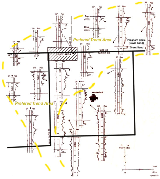
Map 2
Modified from Figure 3 of: Collins, Laubach, Dutton, and Hill, 1992, Depositional Environments, Petrology and Fractures of the Atoka Davis Sandtone: A Low-permeability Gas-bearing Sandstone of the Fort Worth Basin, North Central Texas (Transactions of the Southwest Section of American Association of Petroleum Geologists Annual Convention, Publication SWS 92-90). This paper is supplied in the Appendix. The map shows the electric log (Gamma-ray or Spontaneous Potential on the left tract and Resistivity on the right tract) for a select group of wells in the multi-county area of the study. This study will focus on wells in the “Preferred Trend Area,” as high-lighted between the yellow dashes. In the upper right hand corner, the Pegnant interval and Grant interval have been annotated on the two logs. The Grant sand is not present in all wells; however; the Pregnant Shale/Davis Sand covers a wide region.